
Rafting the Grand Canyon - Sept 2021
Rafting the Grand Canyon is a bucket list travel experience for many people, including my mom. Celebrating a big milestone (her 65th birthday!) seemed like the perfect reason to go big and accomplish this dream. She enlisted my help in preparing and planning the trip of a lifetime to go explore the Canyon on a 7-day motorized raft trip. Here are the highlights and essential take-aways I learned from our trip.
➵➵➵
Packing & Preparing
Extra Handy Personal Items
Nalgene Water Bottle with Carabiner Clip
Sarong or Camp Towel - perfect sun protection and for dipping in the water to stay cool
Body Lotion - constant splashes from the river coupled with the extreme heat and low humidity will leave your skin yearning for lotion
Headlamp with extra batteries for moving about after dark
Extra Large Bottle of Contact Lens Solution - sand gets everywhere including your eyes
A Good Book!
The Absolute River Essentials
Hat and Sunglasses with retaining strap
Rain Gear - spray pants, rain jacket, 1 pair of wool socks
Sunscreen Face Stick & Chapstick
Quick Dry River Clothing - I wore 1 pair of shorts on the river every day for the entire week. I switched between 2 pairs of long sleeve Free Fly quick dry bamboo shirts.
Water Shoes - Tevas etc
Hiking Shoes - Running Shoes, or hiking boots; do note some hikes involve river/ stream crossings
Camp Clothing - Comfy T Shirt and Shorts or a comfy sundress for women
Soft-Sided Duffel or Gym Bag, approx 24” x 12” x 12”
Small Backpack or Fannypack for day hiking
River Ramblings: Tales from the Grand Canyon
Day 1 • Las Vegas to Marble Canyon
We are all packed and ready to go at 3 in the morning. Our pickup spot, the Desert Rose, is already full of the other group members who will be spending the next 7 days with us.
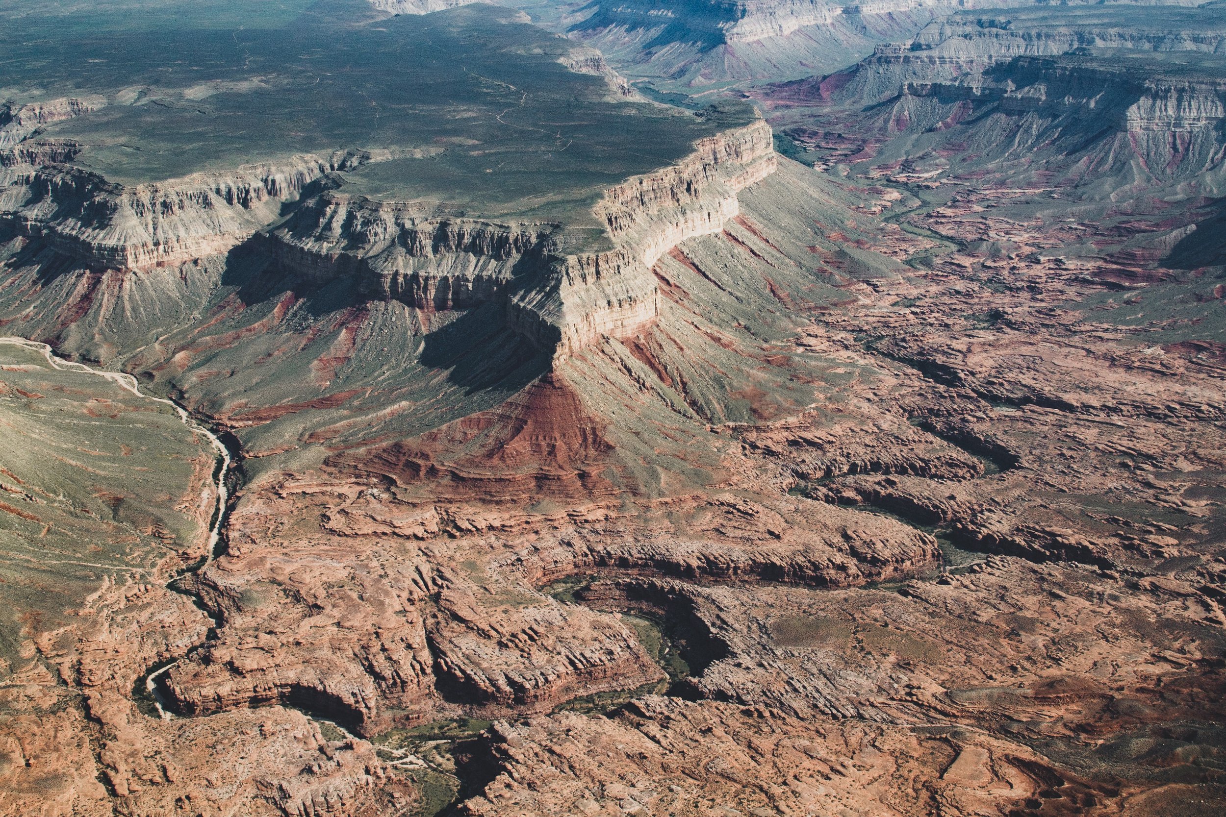
Just when we think all is going well, our plane to Marble Canyon does a sneaky 180° turn back to Boulder City. The pilot tells us there is a mechanical issue and we will be delayed about 1.5 hours. We board our second flight and are able to fly low over the Kaibab Plateau, and the aerial perspective is filled with incredible views the entire flight. We land on a desolate airstrip at Marble Canyon, minutes from our boat landing.


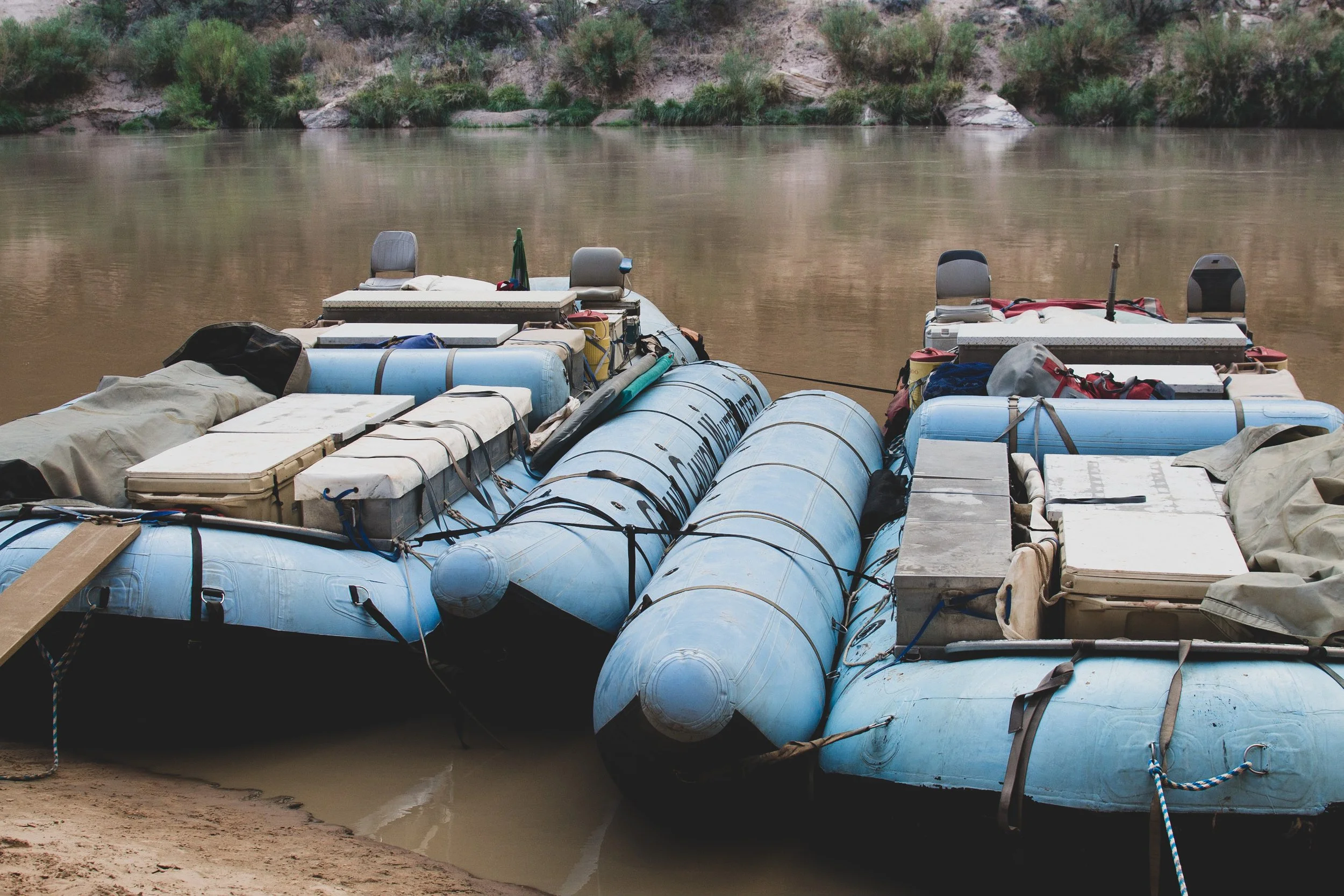
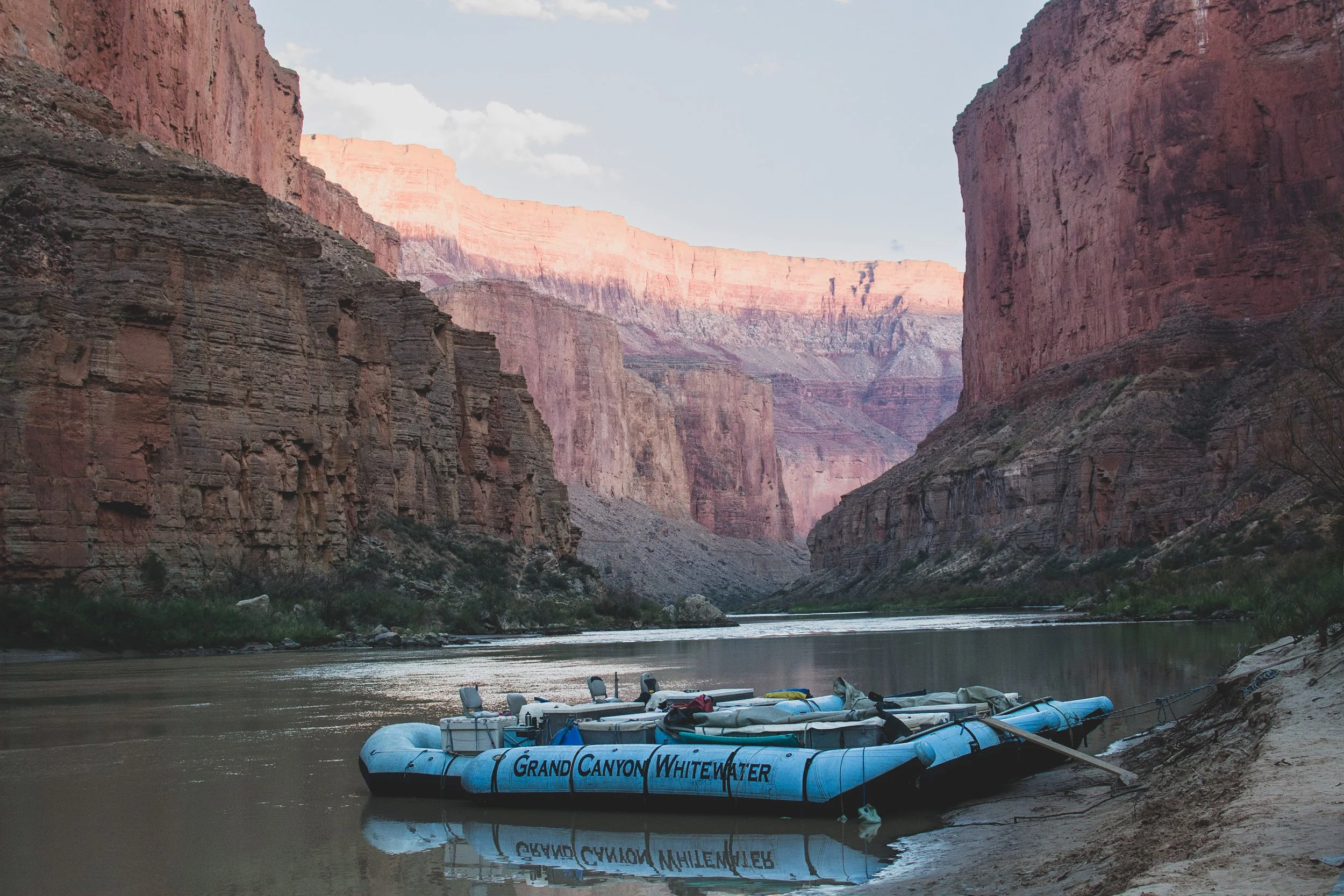
After our expedition briefing, we head down to the boat landing to load our rafts. We have 2 large blue rafts and all 30 people on the trip receive a large dry bag for their belongings. We quickly learn that every morning and evening, we will form a train to load/unload our bags, food, cooking supplies, and other gear from the rafts. The air is hot, approaching 90 degrees, so I stick my feet in the brisk, 52 degree water to cool off. I am anxious to get on the water and get moving.
Lee’s Ferry, River Mile 1
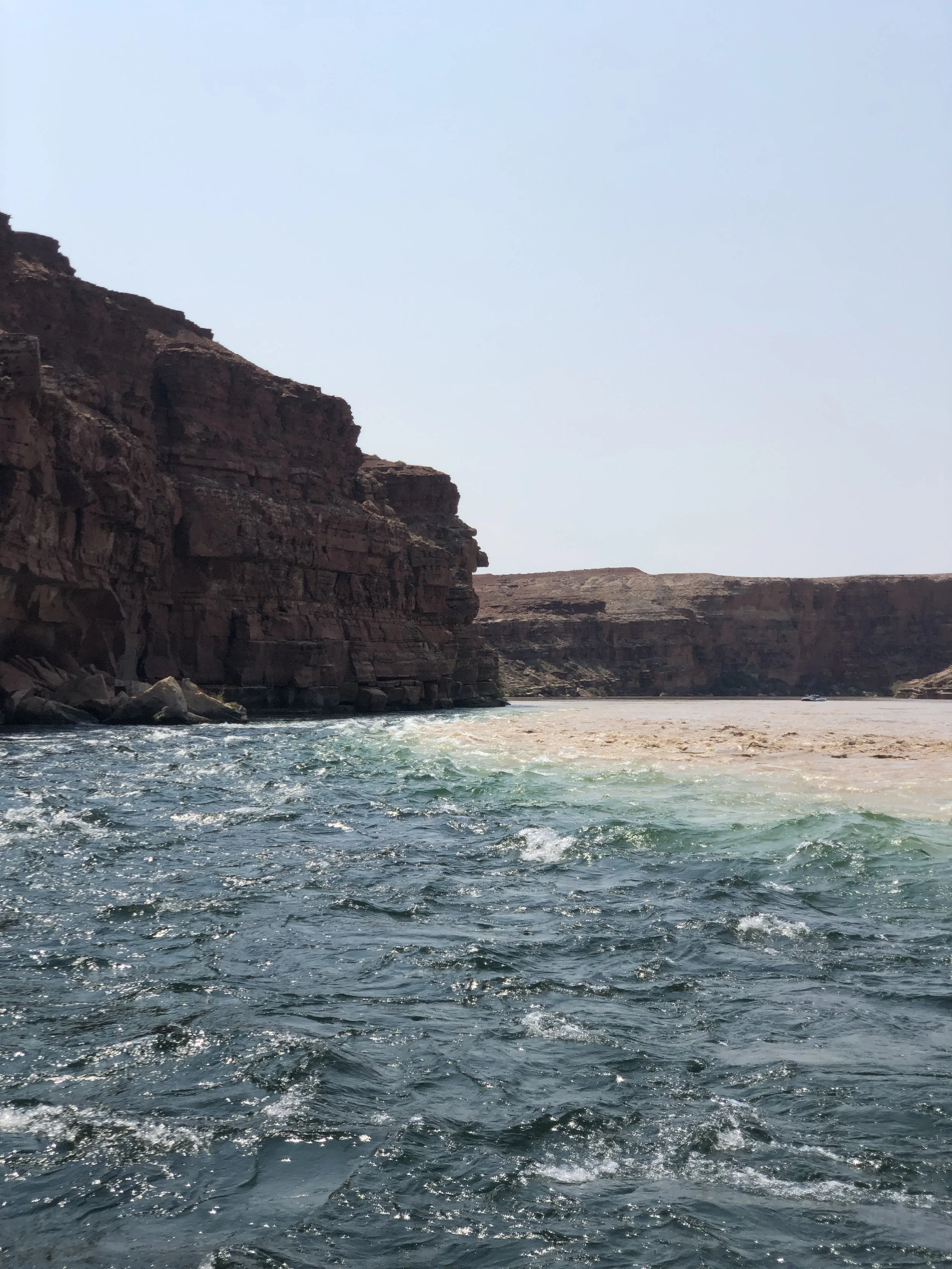
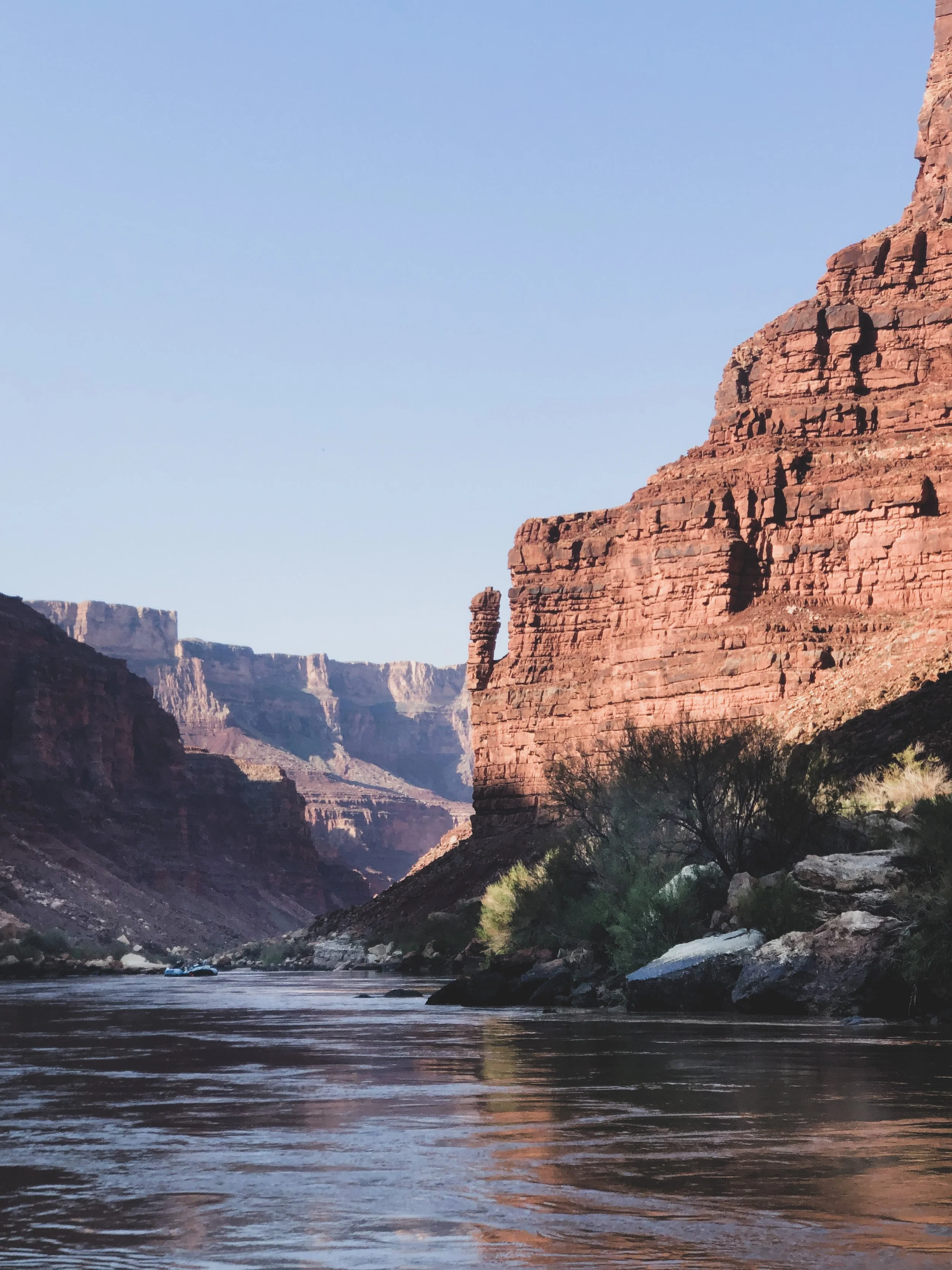
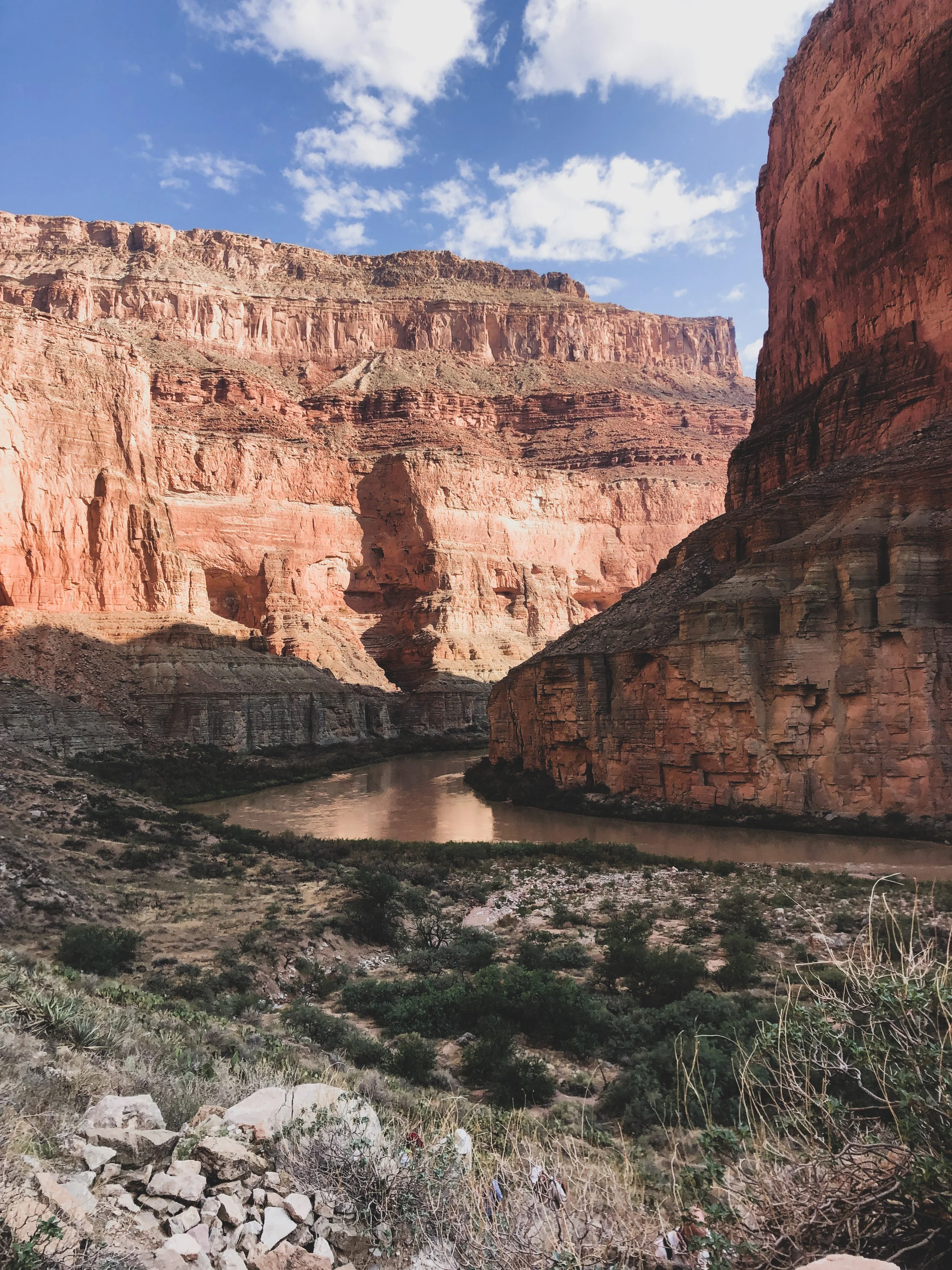
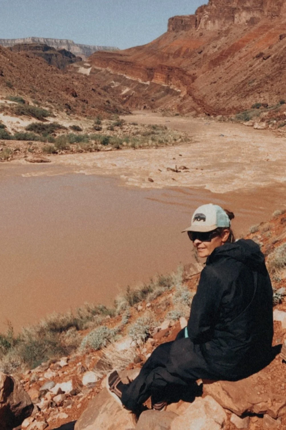
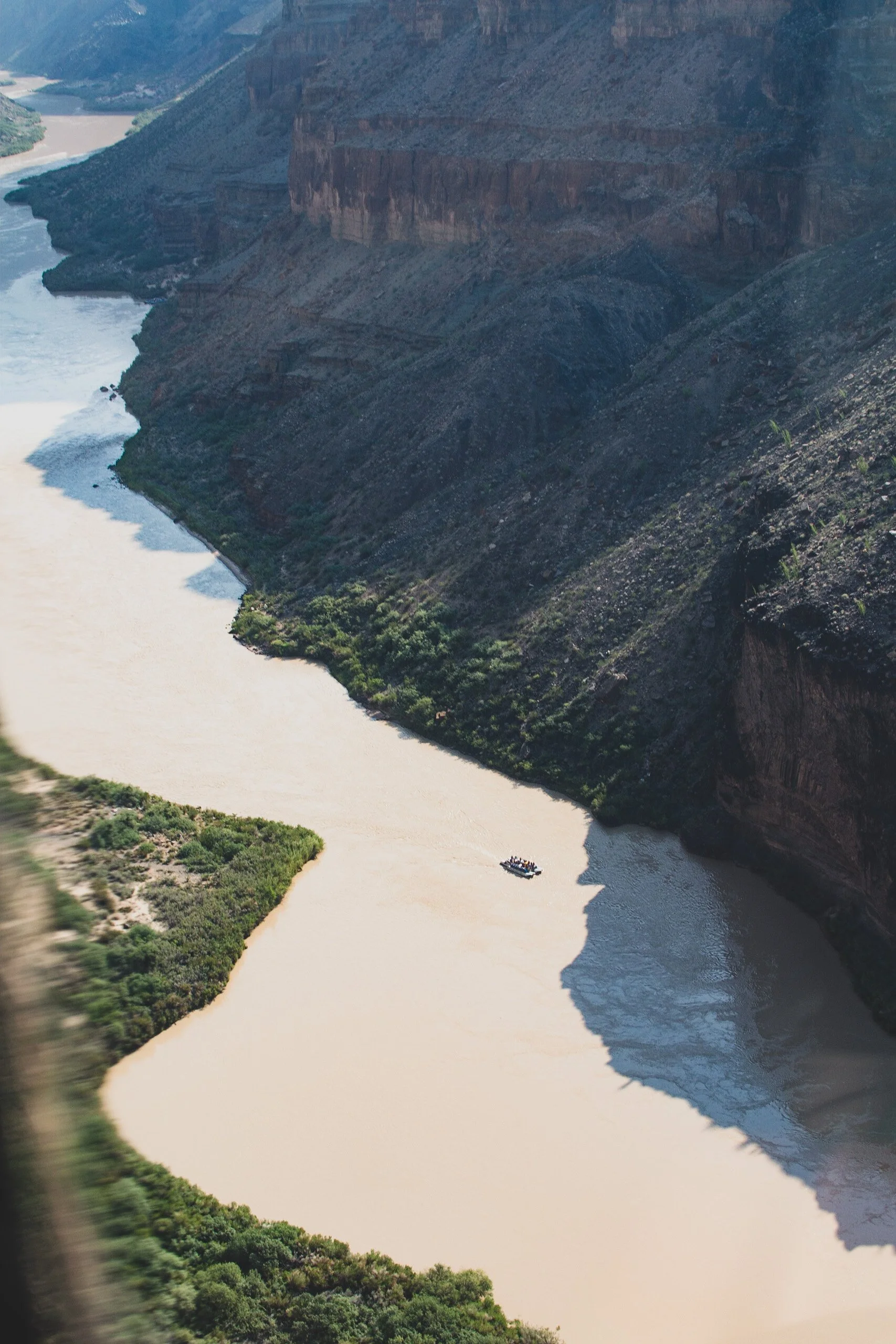
We launch from Lee’s Ferry around noon and the river swiftly pulls us from shore. Water looks fast-moving and clear for about 5 minutes, until we meet the Paria River, which flash flooded from rain in Utah. The confluence turns the entire river a warm toffee brown for the rest of the trip, which we grudgingly accept as it would be the natural color of the river if Glen Canyon Dam did not exist.
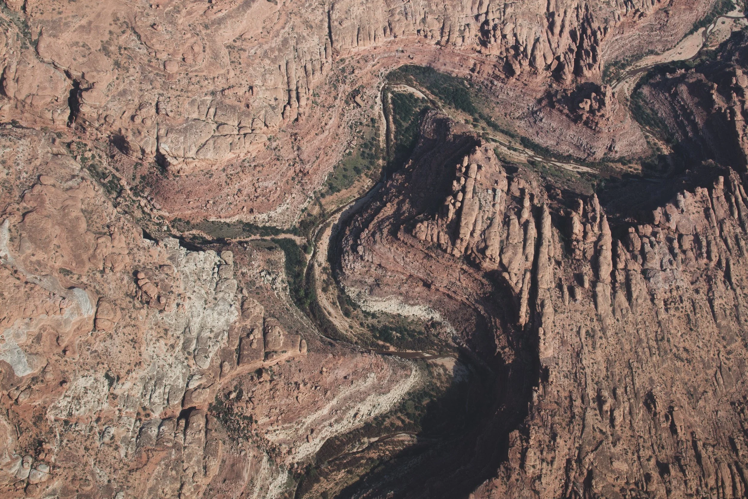
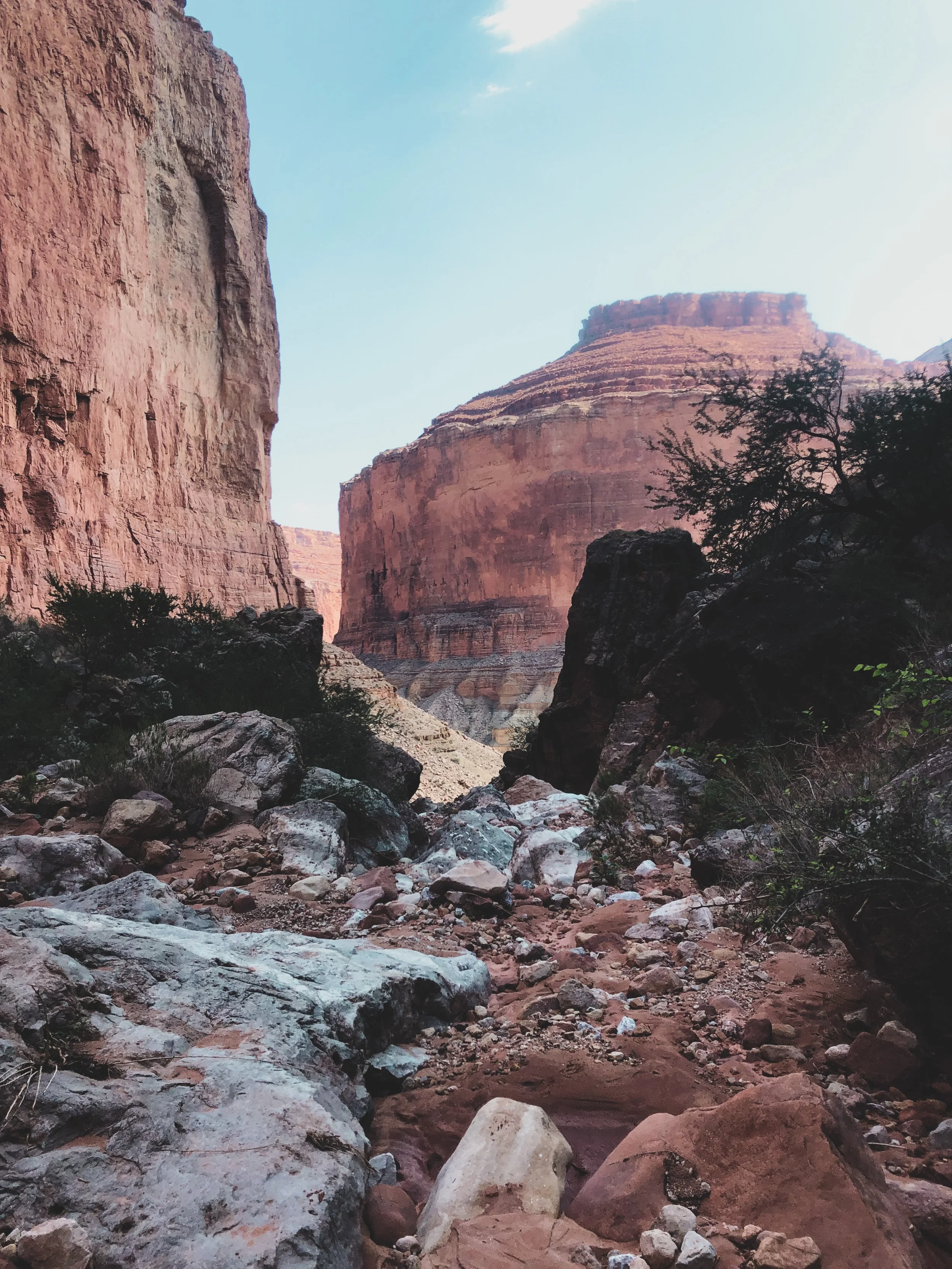
The rating system for Grand Canyon river rapids is unique. It uses a scale of 1-10, rather than the more commonly used 1-5 rating system. This is necessary as the rapids vary drastically from hour to hour depending on the amount of water released by the Glen Canyon Dam. As we encounter our first series of rapids, the canyon begins to stretch up on either side of us, traveling back in time through the geological time record.
After a brief stop along a sandbar and a couple more hours of rafting downriver, we pull into the 19.4 mile campground around 4pm. Dinner is served, delicious salmon with rice and veggies. This is when I realize we are going to eat like royalty on this trip. Suddenly, we hear a giant rolling boom of thunder! We think it might move past us and also, when does it ever rain in the desert?! Well, we made a BIG MISTAKE! As the downpour starts, we scramble to set up tents and get out of the rain. The shower passes by and with such low humidity everything dries out quickly. We go to sleep exhausted but thrilled from all the action on our first day in the Canyon.

Day 2 • First Full Canyon Day: The “Roaring Twenties”
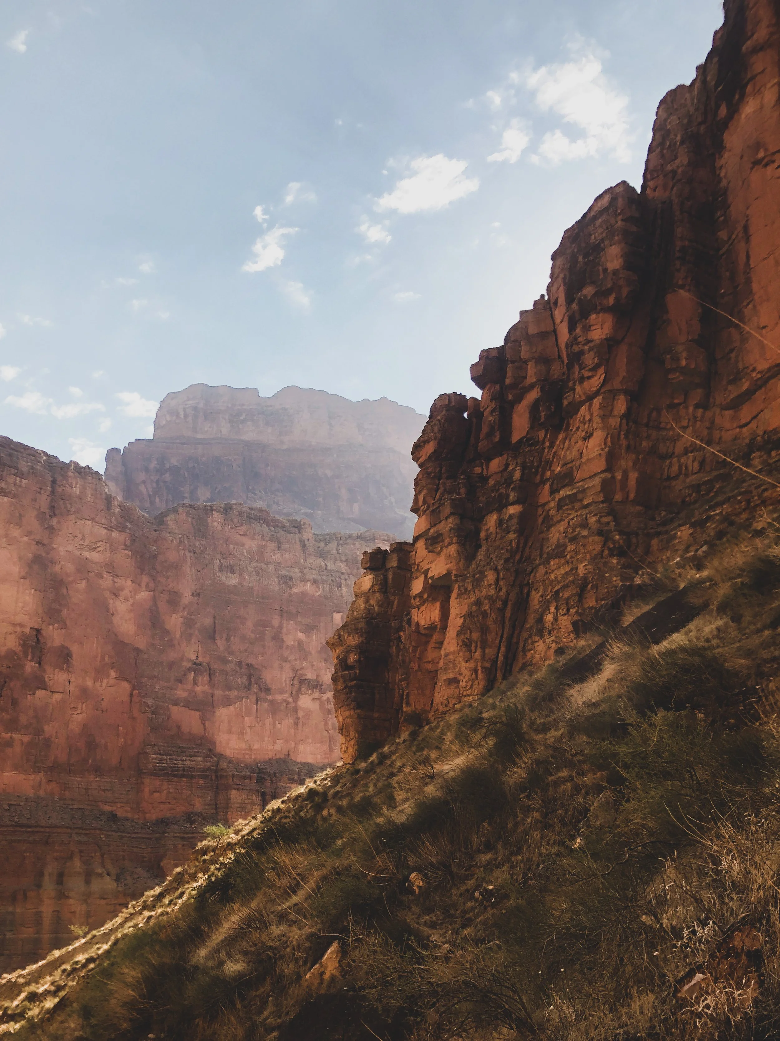
Today is our first full day on the river, and the first thing our trip leader Brie announces is that we will start off riding the Roaring Twenties, Miles 20-30 of the river known for ultimate whitewater bliss. Due to the geologic characteristics of the Redwall Limestone in this part of the canyon, rapids are larger and more frequent! I’m stoked to ride in the very front seat of the raft and experience the thrill and force of each rapid as the waves crash over us, the raft bucking and bending beneath.
The amount of time and space compressed and revealed here, layer by layer, is just absolutely mind blowing. Situated against the incredible backdrop of the canyon walls, our guides regal us with stories from early river runner expeditions, point out evidence from the first Native American peoples who settled here and even prehistoric fossils from millions of years ago.
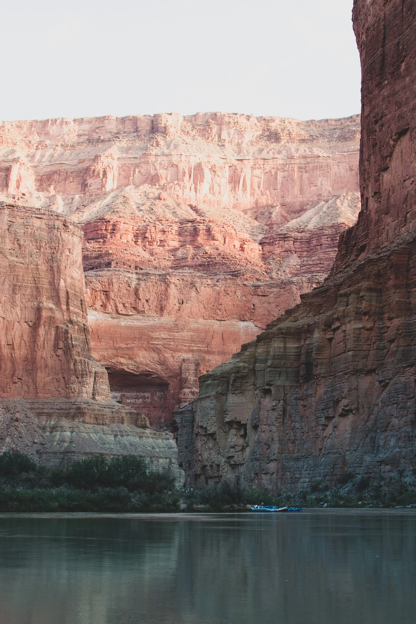
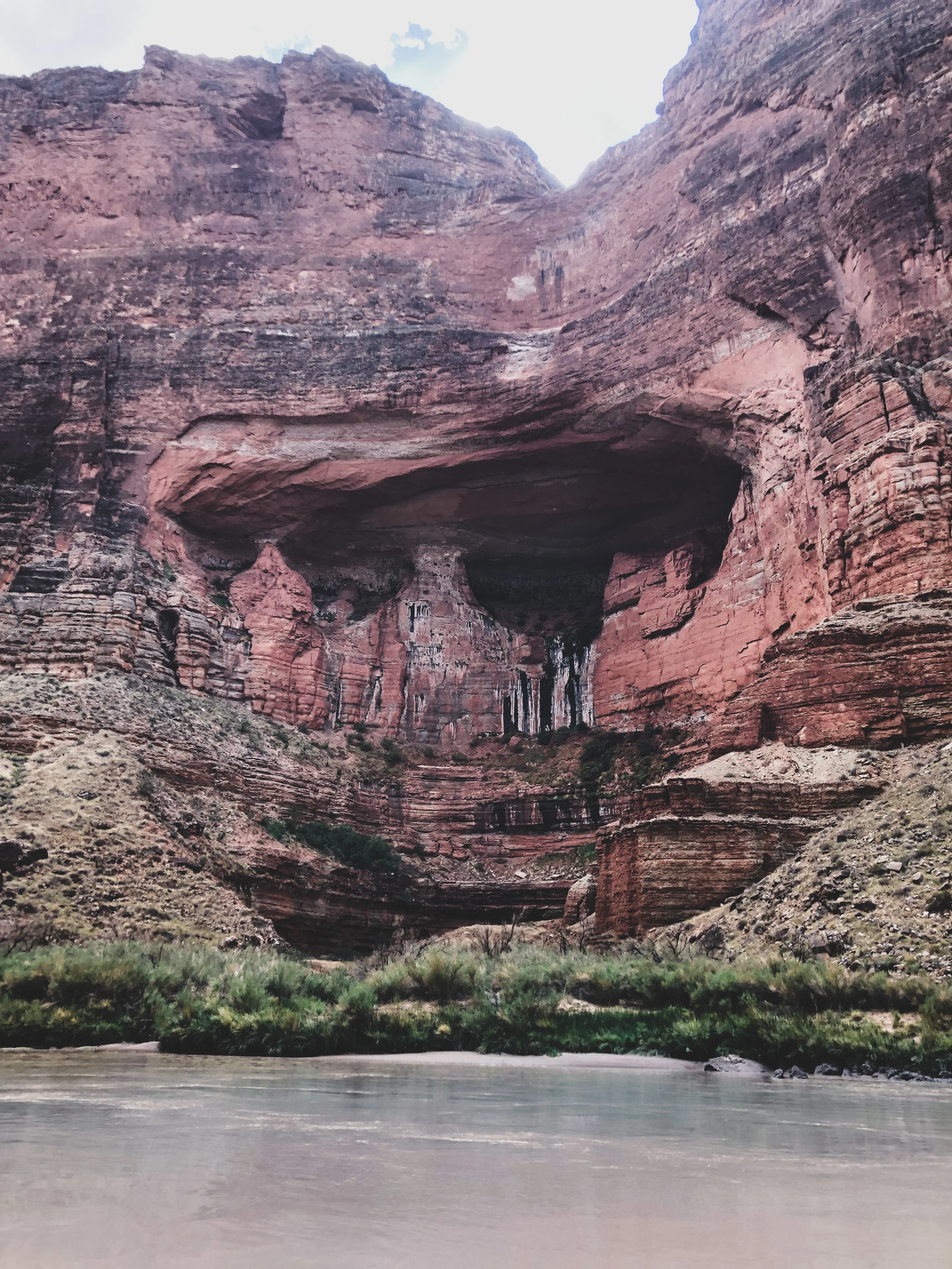
View from Redwall Cavern looking downriver, Mile 33
Located at a great bend in the river at Mile 33, we pull over to explore Redwall Cavern. This immense cavern is carved into the limestone wall and is one of the spectacular landmarks described by early river runner John Wesley Powell on his expeditions more than 150 years ago.
At Mile 43, our guides point out an old Anasazi Foot Bridge spanning a gap in the rock wall 300 feet above the river. This bridge is made from pine trees and helped people from the Ancestral Puebloan culture hike in and out on the canyon’s north side. Across the river, the Eminence Fault created a passage way through the normally shear face of Redwall Limestone to the south. Early on, this route may have been one of the only places where humans could travel between the North and South Rims with relative ease and safety.
We set up camp at Saddle Canyon for the night at Mile 48, while the guides cook us a dinner of baked lasagna. We play a game called Kubb and freshen up with a dip in the river.
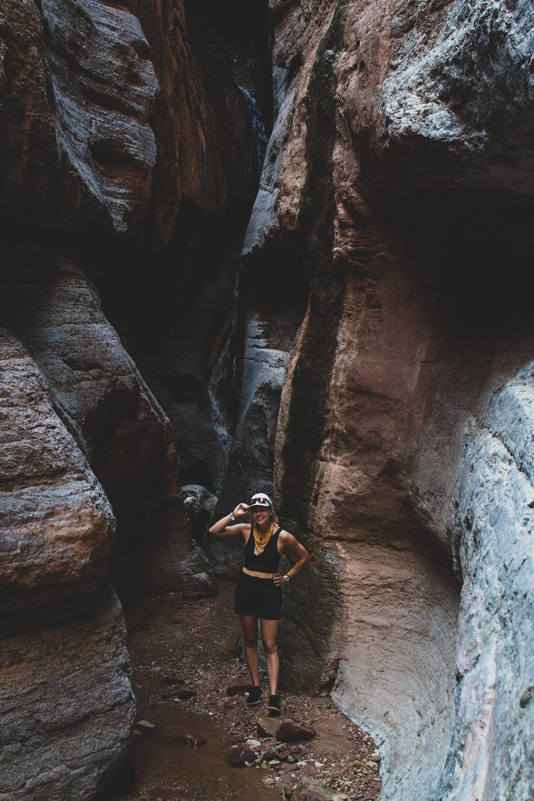
My little Saddle Canyon Campsite 🏕 - This is the last night I really bother setting up a tent. After this I try sleeping under the stars and its surprisingly very enjoyable! Most importantly, no bugs. Coming from camping frequently in rainy places, sleeping under the stars isn’t really a common practice but all my new Arizona friends kept talking about it and convinced me to give it a try.

Day 3 • From Hidden Oases to the Little Colorado
I awake before coffee is called and watch the sun light up the canyon walls. If a place can be called ‘spiritual’ this would be it.
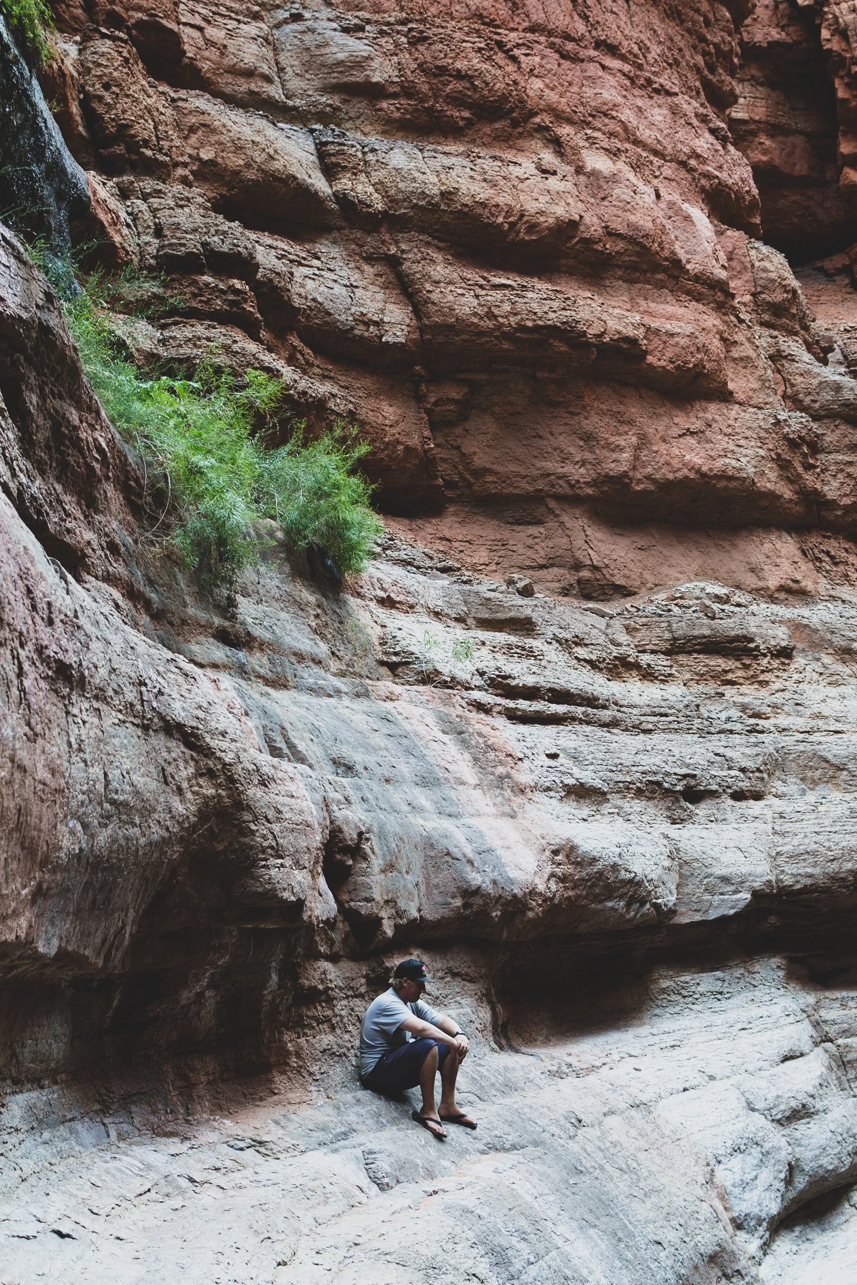
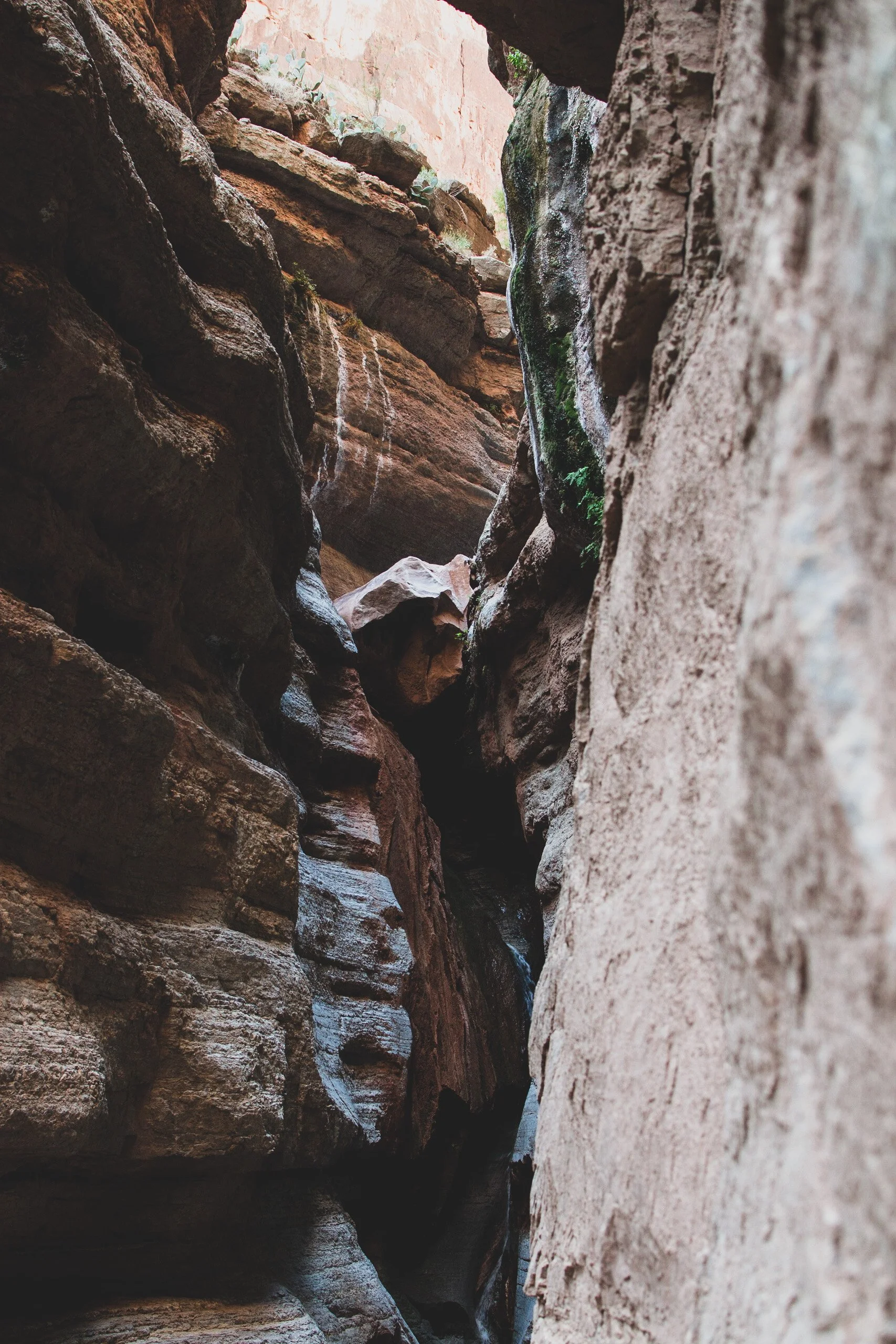
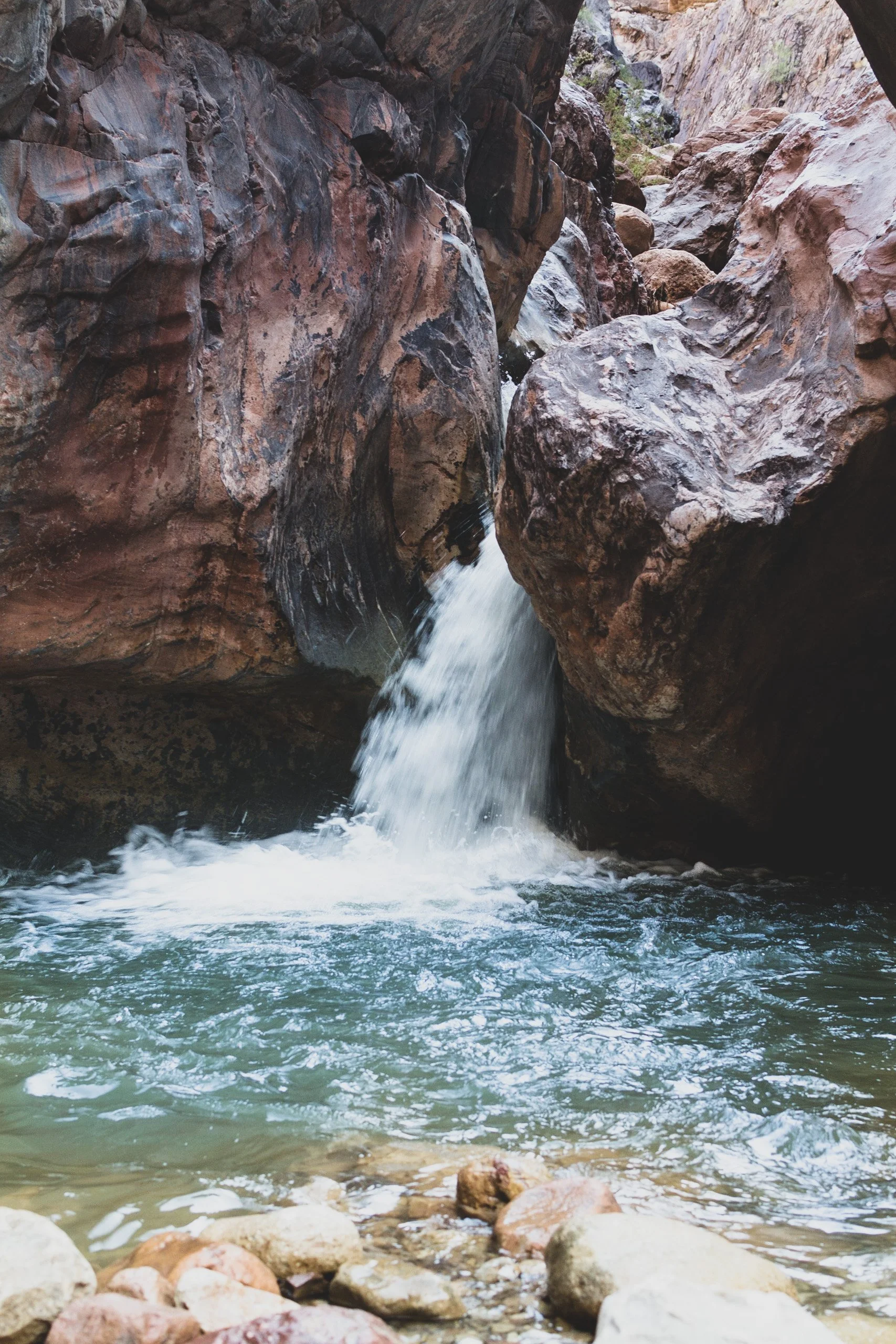
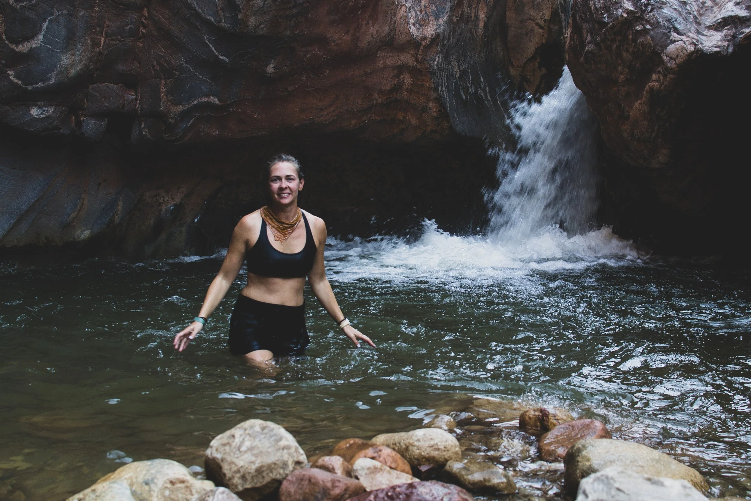
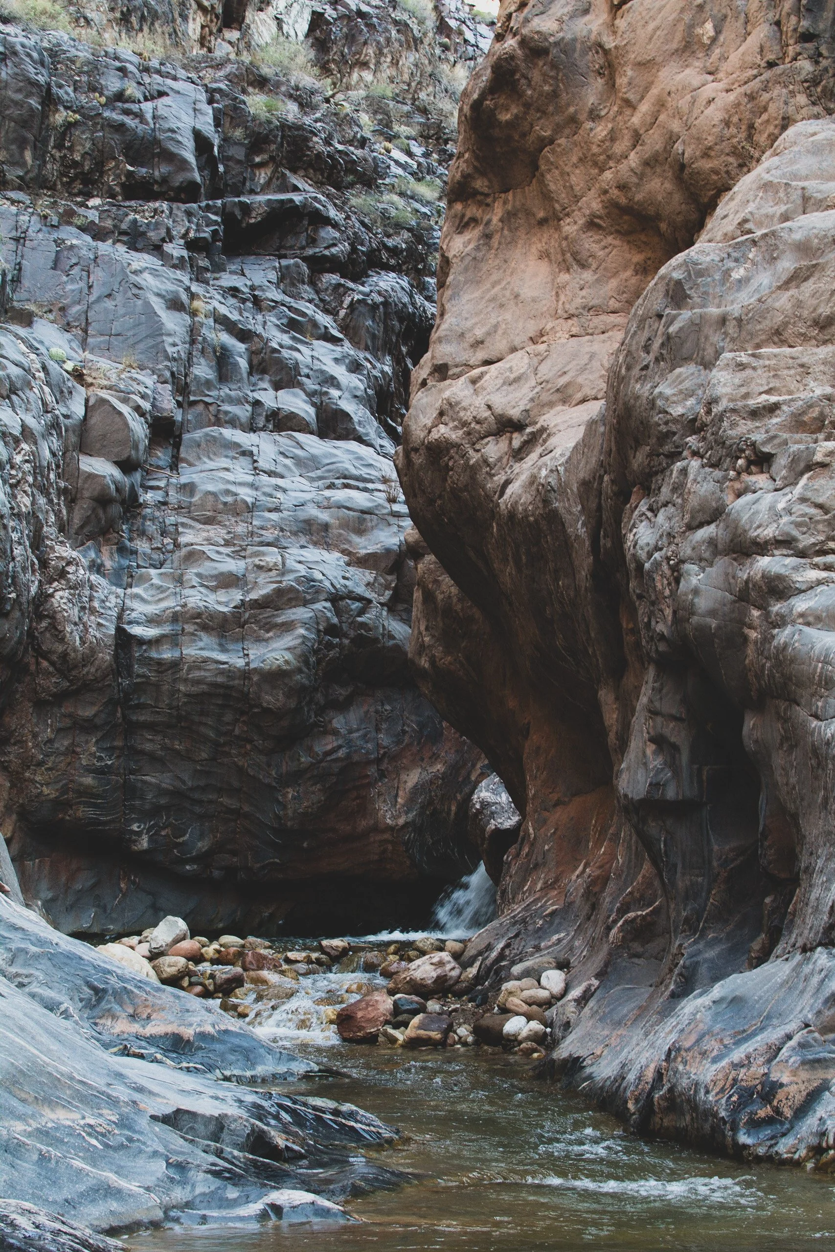
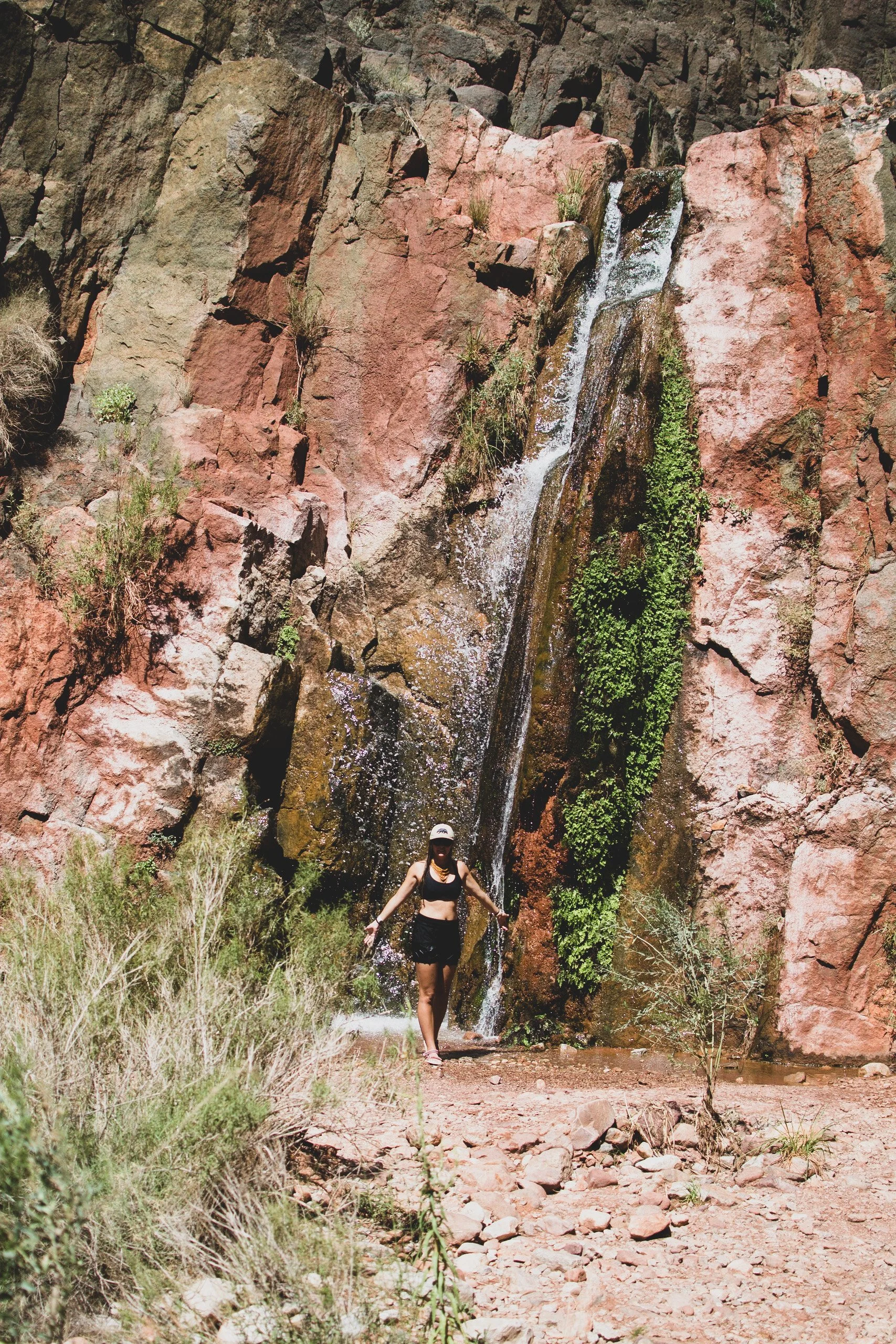
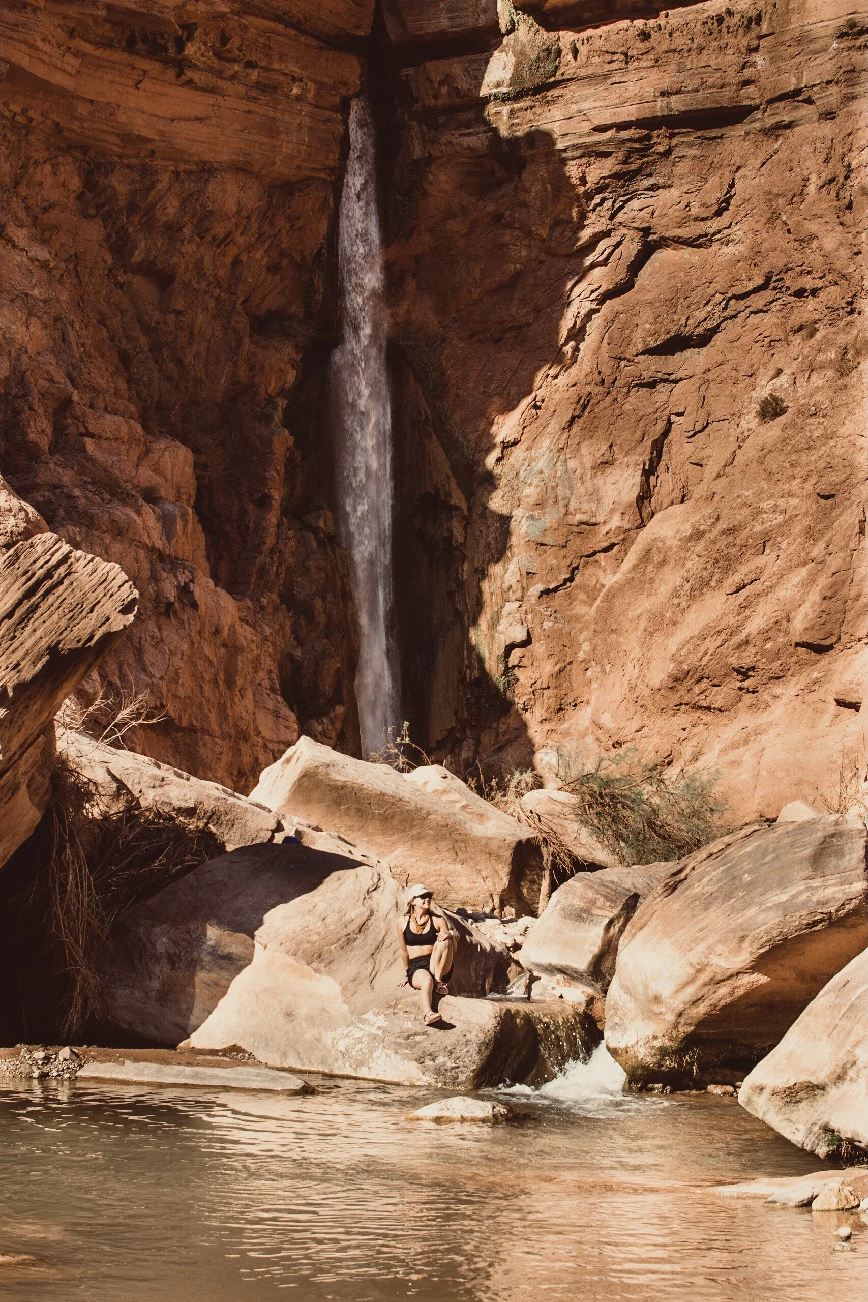
Right next to camp is the trailhead to Saddle Mountain, a steep trek up a rocky slope to a hidden waterfall oasis. Many plants such as cardinal monkeyflower adorn the walls and limestone benches provide welcome respite after a hard climb.
Back on the river, we pass by Nankoweap Canyon and Granaries. High up the limestone walls of the canyon, Ancestral Puebloans built four granaries to store and protect food from pests and weather about a thousand years ago.
Our next destination is the confluence of the Little Colorado River at mile 61.5. When it’s not muddy from the rain, the waters of the LCR are a breathtaking turquoise blue. The Little Colorado is sacred to many Native American peoples including the Hopi, Navajo, and Zuni tribes.
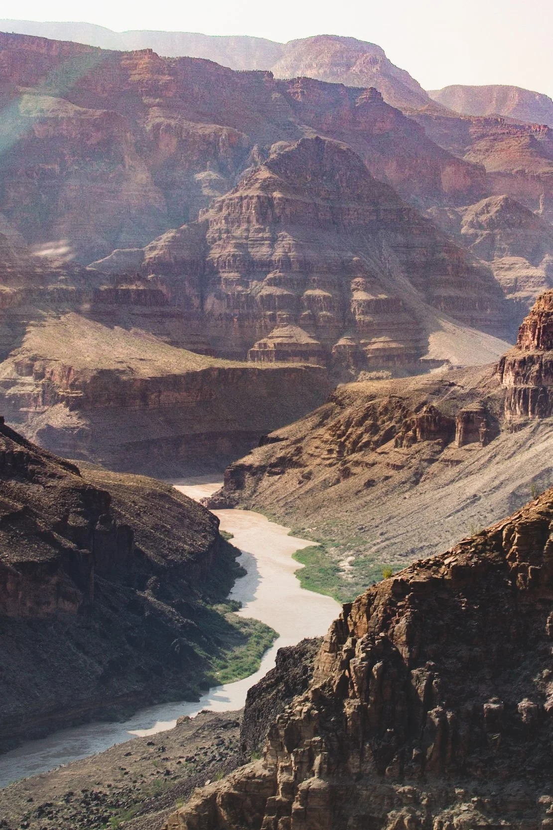
Below the Little Colorado, the main canyon deepens and becomes more foreboding as the river begins to bend westward into Grand Canyon proper. The gradient of the river steepens, flowing over extremely hard rock layers like granite and schist.
Camp for the night is at Mile 63, just entering into the Grand Canyon Proper. In 1956, two airplanes collided over Chuar Butte and nearby “Crash” Canyon, killing all 128 passengers and crew. There were no survivors and after an impressive search and rescue effort, the tragedy here ultimately led to the formation of the FAA.
Day 4 • Big Water and Phantom Ranch
The rhythm of river life is jazzy in the rapids and mellow in the eddies. River life flows with the current and that mentality ebbs into our days. At this point in the canyon, erosion of the soft Dox Sandstone layer leads the canyon to open up. Evidence of Native American activity is widespread; ancient settlements accessed the river for farming, hunting and gathering. Unkar Delta is the largest archaeological site in the Canyon, where archaeologist Douglas Schwartz led excavations to learn more about the lifestyle of the people who once lived here.
At Mile 64 we pass Desert View Watchtower, the iconic landmark designed by Mary Jane Colter and built in 1932 using native materials. Colter designed many other well known landmarks in the area including Phantom Ranch.
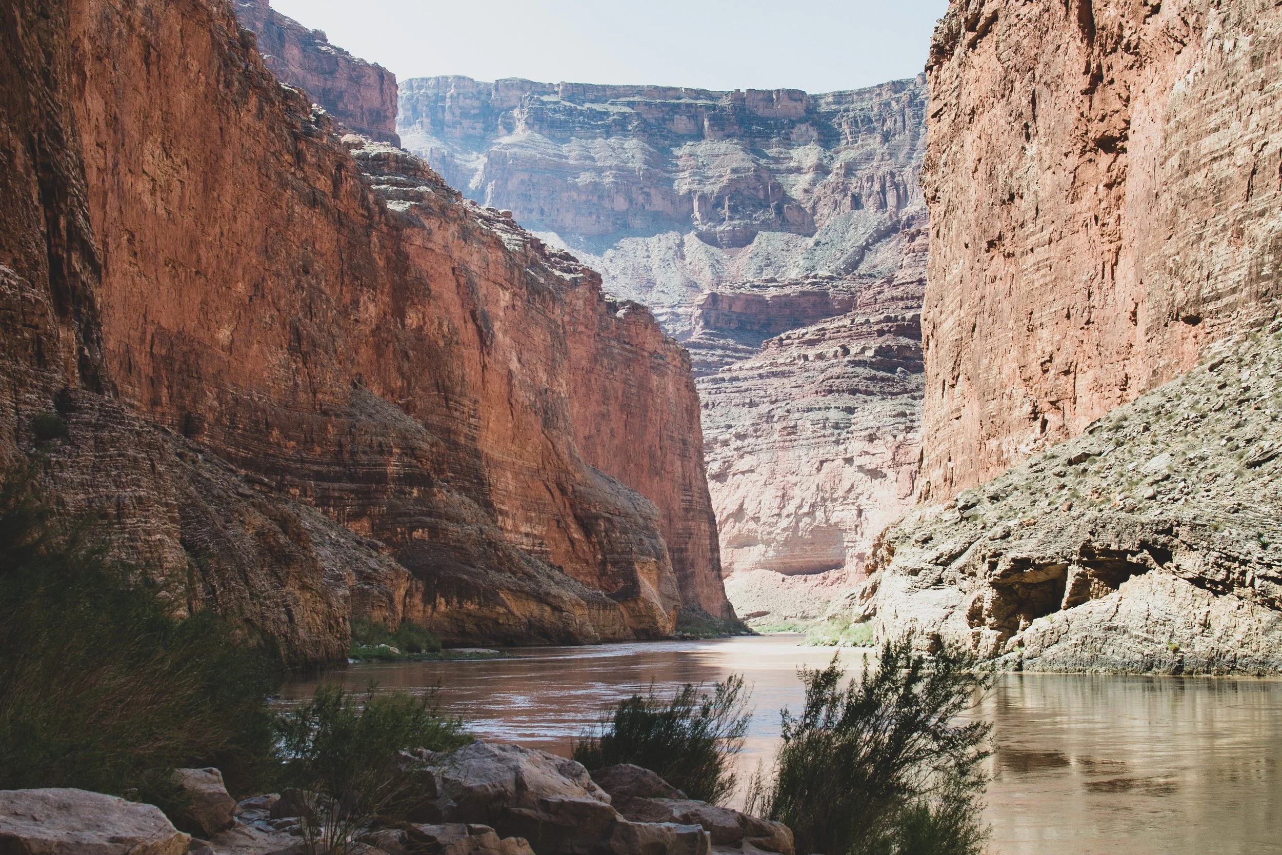
We make a quick pitstop near Hance Rapid, Mile 76.5, climbing up to a viewpoint over the rapid. River runner in training, Bryce, scopes out his line while we all internally ponder the line we’d choose. This rapid’s namesake was one of the first settlers of the South Rim. “Captain” John Hance originally came to the Grand Canyon to mine minerals. In his old age, you could find him at the Bright Angel Lodge telling stories of his exploits and entertaining park visitors.
Hance Rapid Overlook, Mile 76.5
We survive Hance without incident and a great cheer erupts from the raft. Soon after, the rafts enter Upper Granite Gorge. Here we see Zoroaster Granite and Vishnu Schist, the oldest rock layers visible within the Grand Canyon. It’s hard to imagine this geologic ‘basement’ was created 1.7 Billion years ago by igneous and metamorphic rocks and an assortment of powerful geologic forces caused it to reveal itself to us.
Around a few more river bends lies the famous Phantom Ranch, which is situated at the base of two main Grand Canyon hiking trails. A train of mules traverses the Kaibab Suspension Bridge, which is the only way food, supplies and mail are carried in and out of the canyon. Just west of the black suspension bridge lies Bright Angel Suspension Bridge, which was built in the 1960s. Water from the North Rim is piped all the way down, across this bridge, and up to the top of the South Rim 8 miles away, providing the main water supply for all the businesses on the South Rim of the park!
At Mile 98, a series of intense rapids including Horn Creek, Granite, Hermit, and Boucher, are followed by monstrous Crystal Rapid. A major flood back in the 60’s created Crystal, and today the rapid contains several huge holes capable of flipping a raft and a rocky island in the middle of the river which must be navigated to the left or the right. Each line presents a unique set of challenges. The challenges and the risks of error make Crystal the most difficult rapid to navigate in the Canyon.
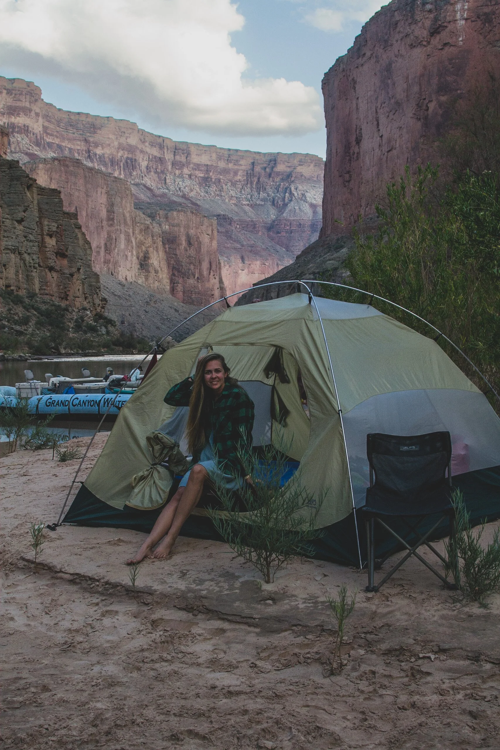
Ross Wheeler Camp, Mile 108
We camp for the night next to the remnants of an old boat named “Ross Wheeler,” which was left by an early river runner on the rocks above the high water line back in 1915. Even though our guides had a rough day, they managed to cook up an amazing dinner of pork chops for the group. We stayed up late gazing at shooting stars, playing games and telling stories about life back home.
Day 5 • The Triple Crown: A Day of Falling Water
Our camp at Ross Wheeler bakes underneath the hot desert sun all day, and temperatures are the warmest they’ve been all trip. I find an effective way to cool off by dipping my shirt into the river and laying under it like a cool sheet. The next morning after breakfast and breakdown, we are back on the water and learn today is “Waterfall Day”.
The first waterfall we visit is Shinumo Falls, a warm waterfall with a rock cavern where we took turns shimmying through a little opening to slide out through the water to the pool in the front! Mighty refreshing after 5 days on the muddy Colorado. Shinumo is a word of Southern Paiute origin, meaning old people or cliff dwellers.
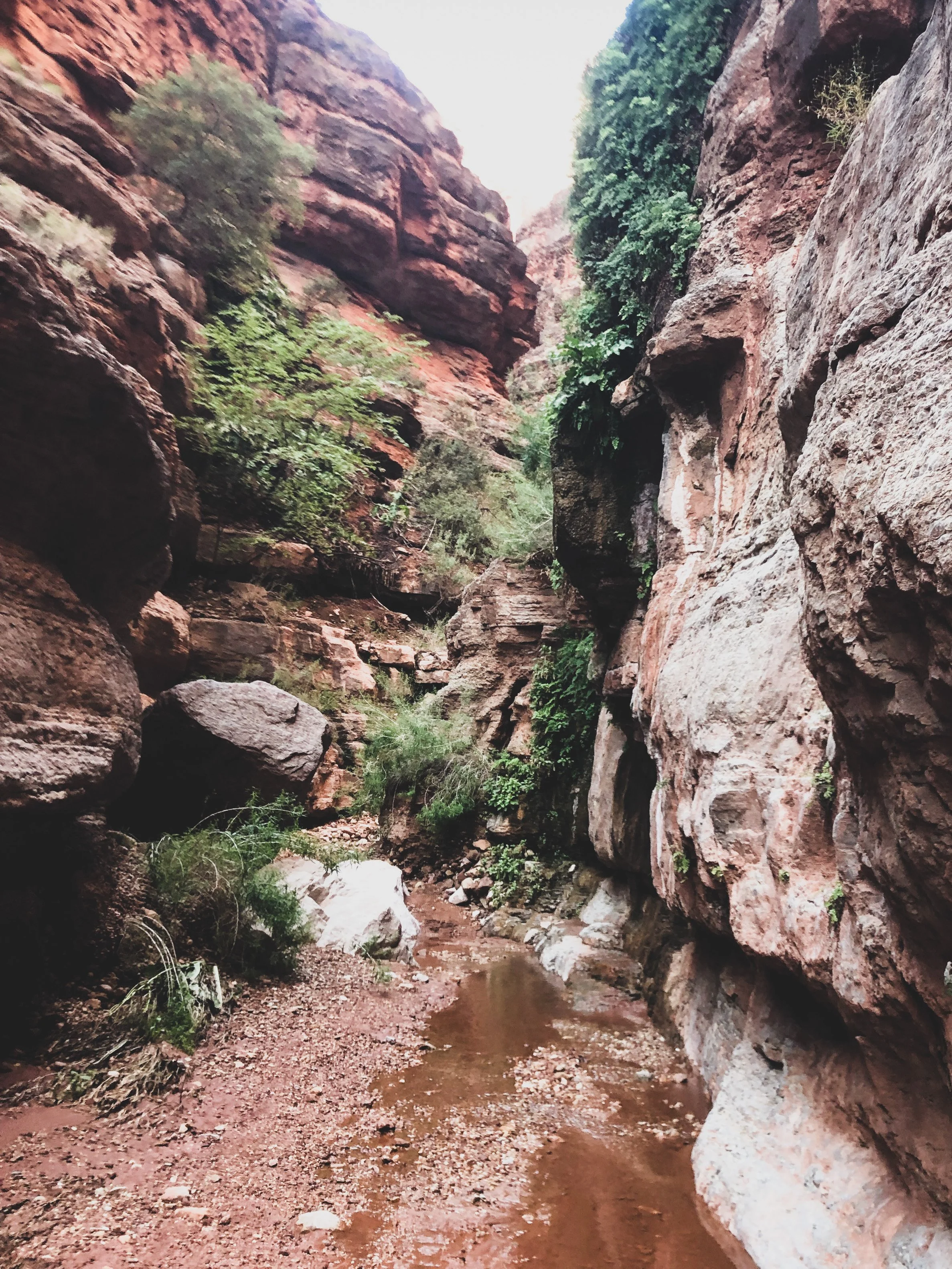
Back on the river, we travel down a series of moderate rapids and pass more spectacular rock formations. Soon we come upon a herd of bighorn sheep grazing along the riverbanks. This section of the river is where you can see “The Great Unconformity”, a strange geologic anomoly where 1 billion years of geologic history is missing from between the rock layers. This mystery is one of the largest gaps of “time” in Earth’s geology.
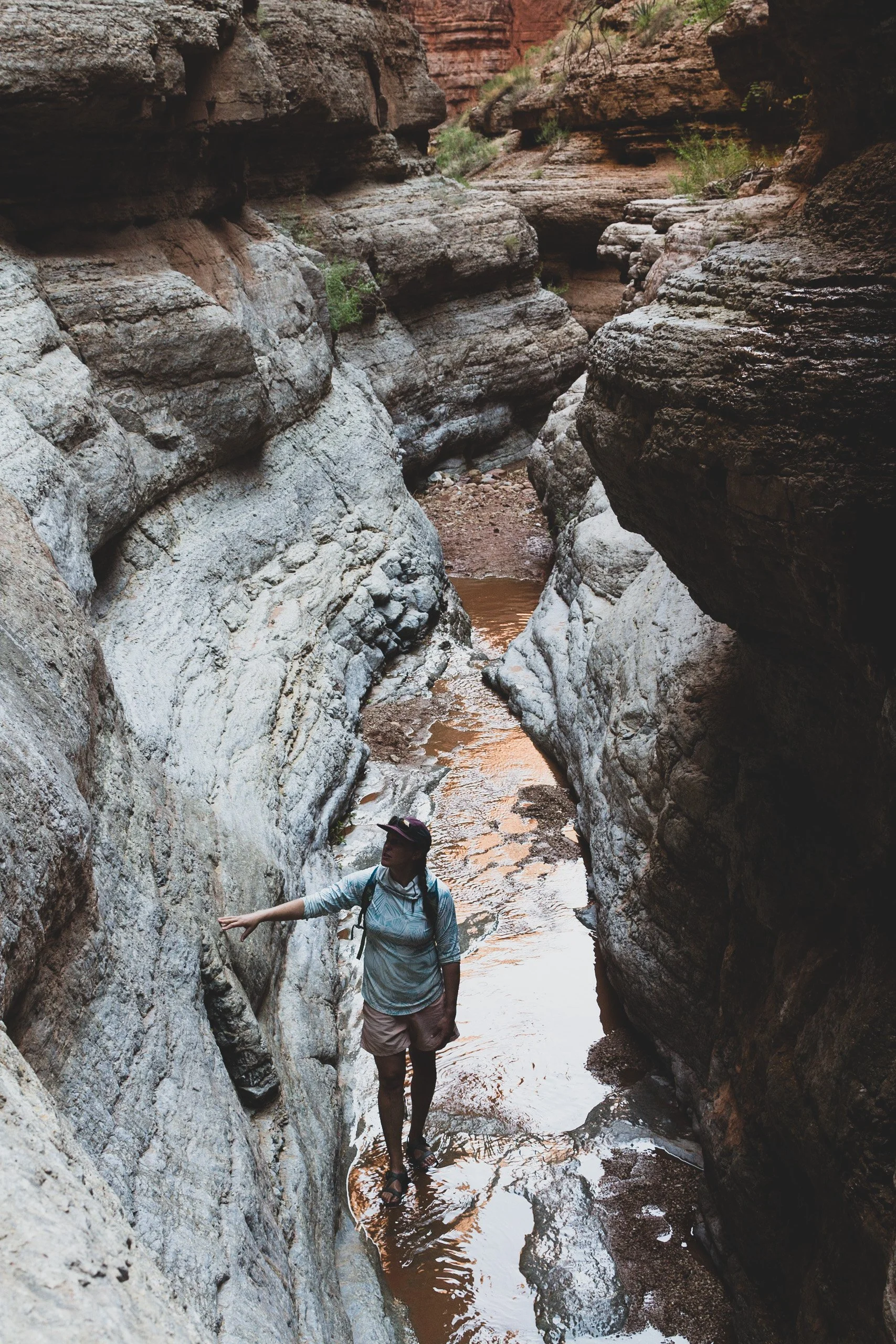
We approach another series of rapids, gaining in intensity before we hit Dubendorff Rapids at Mile 132. Scoping out the rapid from a viewpoint above, it looks formidable and the anxiety in the group reaches a new high. On the water, things start to go wrong and we almost get stuck on a boulder. The motor is damaged again, but we make it down thanks to our guides’ expert maneuvering. We stop at the closest sandbar to fix the motor and have lunch. While Matt and Bryce are making repairs to the raft motor, we wander up a little side canyon to our second waterfall of the day, Stone Creek Waterfall. This waterfall is about 50 ft high and warm, clear water cascades over a small cliff face. Green ferns climb down the canyon walls.
After repairs, lunch, and a few games of Kubb we are back underway. Just beyond Mile 135 we enter the narrowest part of the canyon where the walls are only 76 feet across. The depth of the river here reaches down to 100 feet. Our third waterfall of the day, Deer Creek Falls, is down past the gorge at Mile 137. Deer Creek Falls cascades into a pool from over 100 feet above. Many raft groups converge here to enjoy the refreshing pool of clear water. Some of the groups trek even further to the Patio, an area above the falls only accessible via a steep and treacherous trail.
The river has a funny sense of humor as we discover just around the next bend, where we notice our missing engine cowl sitting high up on a sandbar waiting for us. Just before daylight fades, we pull into Back Eddy Campground at mile 137.5. Fresh guacamole with chips starts off our Mexican fajita themed dinner tonight, followed by cheesecake for dessert. Some folks added some fancy red sauce on top of their desert, and got quite a surprise when they bit into their cheesecake, realizing the red sauce they mistook for a strawberry compote topping was in fact actually some leftover salsa from dinner!
Day 6 • Lava Falls: Our Last Whitewater Hurrah
Olo Canyon at Mile 145 - Since it is younger than other side canyons, the water has not eroded all the way to river level and spring water gently cascades over Olo Canyon’s mouth, falling 20-30 feet to the sandy shore below. Gazing upon the many sculpted cliffs of the Grand Canyon, I notice an abundance of U-shaped curves in the rocks which I can imagine were once waterfalls from millions of years ago when water cascaded over the canyon all over the place.
Home to the people of the blue-green water, Havasu Canyon at Mile 156 flows through Supai Village, one of the most remote places in the United States. I visited Havasu lands in 2018 (see here and here for more info on that trip!) and loved exploring the incredible waterfalls and travertine terraces of their land. The Havasupai and Hualapai Reservations are adjacent to Grand Canyon National Park and their people have called this land home for centuries. We unfortunately couldn’t stop at the confluence to explore Havasu this trip, but sometimes rafts stop here and groups can walk up the creek a ways.
We pass Havasu Canyon and quickly enter a strange new section of the river. Around Mile 179, ancient volcanic eruptions spewed volcanic material into the canyon, creating lava plugs, dams, and Lava Falls, the most famous Grand Canyon rapid and one of its most formidable. As we approach Lava Falls, we can see a distinct horizon line, right before the river drops off dramatically. The rapid is powerful and fast-moving, but we make it through without a scratch!
The guides cook us one last amazing steak dinner to celebrate wrapping up our week-long expedition down the canyon. They pass out little river rat pins to commemorate our epic adventure and share some closing thoughts with the group, reflecting on all the great memories from our trip. Then we stay up late under the canopy of stars telling stories and playing games like we’ve known each other all our lives.
Day 7 • A Whirlwind Exodus
Before the use of helicopters, river expeditions would hike in and out of the canyon on a narrow trail, assisted by mules. Fortunately for us, there is a helicopter service which airlifts us out of the canyon to a modern Western-style ranch on the plateau where we enjoy a shower and lunch. We board a fixed wing plane that takes us back to Las Vegas. And just like that, our trip is over and we are back in the real world.

➵➵➵

